Diving Lundy Island 16-19 June 2007
To many people, Lundy is the twentieth area in the Shipping Forecast, always appearing between Sole and Fastnet. Connections: The Meteorological Office, which produces the Shipping Forecast, was founded by one Captain Robert FitzRoy in response to the number of lives being lost at sea due to the weather. This same Capt FitzRoy of HMS Beagle took Charles Darwin on his famous journey 1831-36 that resulted in the publication of “On The Origin of Species” in 1859. Also on the Beagle voyage was Sir Francis Beaufort, who had previously [1805] introduced the wind force scale that bears his name. Robert FitzRoy was a descendant of the first Duke of Grafton, one of Charles II ten (or so) illegitimate sons – his mother being Barbara Villiers, Duchess of Cleveland. The shipping forecast area Finisterre was renamed FitzRoy in 2002.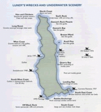
Lundy Island is about three miles long by about half a mile wide, oriented North-South; most is around 120 metres above sea level. It lies about 11 miles from the nearest land, but about 24 miles from the nearest harbours.
The West coast gets battered by the full force of the Atlantic Ocean, with nothing to protect it, and the coastline is very steep and rugged – very popular with climbers. The East coast is more sheltered and lies in the Bristol Channel – the coastline being a bit less sheer. The island is bathed by a mixture of the Atlantic Gulf Stream and warm waters rising from the Mediterranean resulting in very clear waters, away from land pollution with different flora and fauna on the two sides of the island [you remember Flora and Fauna from the Addams Family?]. Most of the East coast is a “No Take Zone” so there is even more to see.
The island is mostly granite but the South end is poor quality shale tipped by geological forces almost on its edge and so is rather fragile – this has created the only viable landing beach on the island but has meant that the sections of the roadway up from the beach have been swept away by landslides over the years. At the time of our visit, a major project was under way to strengthen this roadway and shore up the mountain side. I say “roadway” – a 4x4 would be needed!
We met the dive boat at Ilfracombe just after 11 am, having left Nottingham just after 5 am (I say again FIVE AM on a SATURDAY morning!!). Our vehicle was the last to arrive as we'd chosen the scenic but winding and hilly coastal road instead of the slightly longer, but considerably faster, inland route. After quick introductions, we loaded all of the dive kit, luggage and people onto the dive boat and set off for the island. The sea was flat calm on that day (Saturday 16th June 2007) and we made the crossing in about 50 minutes. The whole of that day was warm and sunny and I found out later that the weather back home was not to be envied.
There were nine of us in the party – seven divers and two children. The father of the children planned not to do much diving with us, instead using the trip as a family holiday.
Team Lundy 2007 – Allan, Dave, Mark, Rob,
Gilbert, Imogen, Tessa, Trev and Steve →
Our first dive was at Brazen Ward on the East side of the island. We dived as two groups of three.
↓ photo of Brazen Ward and two photos during the dive

Moving slightly further North, our second dive was at Gannet’s Rock in Gannet’s Bay.
two views from sea level at the end of this dive →
After diving, we waited for the ferry MS Oldenburg to depart, then got all the luggage, tanks, suits and people ashore, leaving the rest of the dive kit aboard. There is a substantial new concrete jetty leading to the dive centre and the start of the road. I say “dive centre” – it is really a boat shed, compressor and a couple of small changing rooms, one of which was allocated to us and where we could leave our suits to drip dry overnight. The compressor is operated by the island’s Warden who also drives the Land Rover which takes your luggage up to your accommodation. It was left to us to trudge wearily up the winding roadway towards our lodgings.
← view of the concrete jetty and “dive centre”

the view of the landing jetty from half-way up the road→

view from the top – the landing jetty is in the bay in front of the last island on the right →
Only about sixteen people actually live full-time on the island and they all work there – there are no locals who have been there for generations. I had wondered whether the “locals” were fiercely independent (as many island communities tend to be), speculating on whether they used terms such as ‘North Island’ (for Wales), ‘East Island’ (for Devon and the rest of England) and ‘South Island’ (for Cornwall) – but this is not the case. Most of the buildings on the island have been converted in recent years into accommodation for visitors who can book for the week or just a few days – the population increasing to about one hundred and twenty; there is also a camping field for tents.
Our accommodation was the Barn, nicely converted to sleep 14 in two dormitories. It also included a kitchen area, two toilets, a shower and a large communal dining area. All cooking and dining utensils were provided, as were beds with mattresses – most of us brought our own sleeping bags, although duvets could be hired.
The Village consists of a pub (The Marisco Tavern, named after the Norman family who held the island after the Conquest) and a small shop. There is also a church standing alone, further down the road. The shop only opens during the days when the ferry sails and for a few hours on other mornings. By the time of our arrival, the shop had already closed, but was re-opened for us to collect any supplies we needed (although for some reason, the tills were not working, so we had to run up a tab). While we were on the island, the ferry was only sailing on Saturdays, Tuesdays and Thursdays (weather permitting) – it sails more often during the peak season and is replaced by a helicopter service in the Winter.
(↑ the first photo is a view from the bedroom window
with the pub straight ahead and the church behind it;
the shop is in the building to the near right.
The second photo is of the church)
We all went to the pub for a meal that evening and it was still warm enough to eat the main course outside, adjourning indoors for the dessert – I’ll let you guess what I had to eat! In between eating and talking, I managed to write my postcard, having remembered to buy some earlier together with Lundy stamps – having been told that normal UK ones are not valid there [I found out later that this is not exactly true].
Day 2 (Sunday) – on the walk down the access road, we were greeted by a sign stating that there was no access beyond that point due to the work on the roadway – they must have assumed that with there being no ferry on the Sunday, no-one would need to get down to the jetty. We bravely took our lives in our hands and ignored the sign, there being no other safe way down (apart from abseiling!). Fortunately, they were spraying concrete onto the sea-ward side of the wall under the roadway, so we didn’t leave any footprints for posterity in wet concrete. The captain’s mate this time was Morris who had retired from running a dive boat some years ago – if you imagine Popeye with Santa’s white beard, you are not far off – what a character!
The sea was a little bumpy on the East coast in the morning, so we dived Battery Point on the West coast for our third dive. I took both of my pony cylinders on this dive as it was our first deeper dive. On reaching the bottom, I helped another diver whose fin strap had come loose, then my dive buddy pointed to something below me – my air pony had fallen off and was hanging by the pipework from my jacket. On inspection, I found that the small nut holding the two halves of the clamp system together had come loose and in picking up the cylinder, the rest of the bolt fell out to be lost in the silt. I spent the rest of this dive carrying the pony. What is more, my Nitrox regulator went on free flow for a few seconds right at the end of this dive – the yawning chasm of the Incident Pit beckons . . .
(←Battery Point is named because before they built the
first lighthouse, they used to fire blanks from a cannon;
the photos show it from the sea and from land)
Having realised that my air pony clamp couldn’t be repaired without spare parts, I adjusted my weighting and used just my Nitrox pony for the fourth dive – the MV Robert which lies a short distance off the East coast (this side being calmer in the afternoon). Having arrived on site, we politely waited for the divers from another dive boat to complete their dives before we entered the water. A bit of a mistake as the visibility was not as good as we were starting to expect from Lundy. The MV Robert sank in 1975 and is Lundy’s only intact wreck, lying on her starboard side in about 25 metres (18 m to the port side).
Back on land after diving, two of the team went coasteering – a relatively new sport where you follow the water line along a coast, climbing along the rocks (never far from the water) and swimming where climbing is not possible. Rob is an expert in this and he had brought enough spare kit to take one other – in this case, Trev.
We watched them until they disappeared out of sight, then made our way back to our accommodation for a cuppa. After this, we went exploring part of the island – across to the West side to the Old Light and Northwards for a short distance. The Old Light was a lighthouse built in 1819 and was the highest in Britain – so high that it was above the fog and so it was abandoned and lower lighthouses were built at the North and South ends of the island in 1896. The keepers’ house is now available for guests to rent. Climbing the Old Light gives a panoramic view of the whole island.

Day 3 (Monday) and the dive boat was Obsession II, captained by Andy, who owns both boats – he had intended to sell the older boat, but has enough business for this season to keep both for the time being. Anyone with £140k to spare and boat handling skills, please apply to . . . This new boat had a hydraulic lift at the back – talk about luxury!

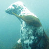
We followed the same pattern as the day before by starting on the West coast with Jenny’s Cove for dive five. Our group of three wandered around exploring and eventually decided to head West into deeper water. On returning to the boat, we found that the other group of three had headed East (towards the island) and been treated to a long encounter with a very playful seal!!
 For dive six, we had planned to see if the viz was better on the MV Robert, but the sea state wouldn’t allow that, so we stayed close to the island and dived the Knoll Pins on the East coast. These are a pair of large rocks with a gully between them and the plan was to dive in a figure‑8 around them. The sea bed is flat beside the almost vertical faces of the rocks, but on moving away from the rocks, the sea bed slopes down – as if the sea has piled a load of sand around the rocks. During this dive, we encountered what must be the biggest lobster I have ever seen – and yes, we were within the “No Take Zone”. Towards the end of this dive, I was carefully lining up for a photo of something interesting when a dark grey torpedo shot between us – a seal had dive bombed us and did so a couple more times and we gently ascended looking all around for it coming back – what a way to end the diving holiday! Back on land after diving, Rob took Steve coasteering.

Sometime during this day, it dawned on me that my postcard, so carefully written on the first evening and bearing First Class postage, would probably not get off the island before I departed for home since there had been no ferry during our stay! [I must have been in particularly scintillating intellectual form that day!]

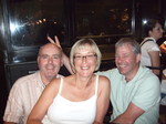
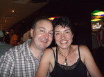
↑ Steve, Dave, Allan ↑ Trev, Tessa ↑ Imogen, Rob, Gilbert
Day 4 (Tuesday) – the day of departure. We were concerned that we’d not seen the Warden the night before and didn’t know how to contact her as we needed to pay for our air fills & landing fees and organise getting our luggage transported down to the jetty – we were due to be picked up around 09:30 – much earlier than the ferry was due. There was also the issue of settling the tab at the shop! Fortunately, we managed to sort out what we owed and organise the luggage; the shop having opened early for us and I had decided to send myself a postcard [sad!] in order to get the stamps – this postcard arrived on the Friday.
I will admit that after three good days, Tuesday would not have been suitable for diving! We did get down to the jetty in time to meet the dive boat (Obsession II) and our luggage had already arrived. We quickly collected all remaining kit from the changing room and got the luggage and people on board.

The crossing is best described as “rough”, but with a £200k catamaran, we made the best and safest progress possible and arrived back in Ilfracombe after about an hour and a half.
We decided to check out the local fish & chips [we were on holiday] as it was lunch time, and were greedily watched by the local seagulls. Some of us (who shall remain nameless) also decided to try out the local ice cream!
After saying our goodbyes, we set off for home – this time taking the much faster inland route.
Overall, an excellent diving holiday – and we fared much better than back home for the weather. Although staying on the island made it more expensive, I would say that it was well worth it and look forward to being able to go again.
Mark

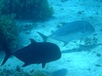
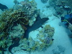
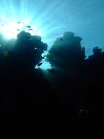


 For dive six, we had planned to see if the viz was better on the MV Robert, but the sea state wouldn’t allow that, so we stayed close to the island and dived the Knoll Pins on the East coast. These are a pair of large rocks with a gully between them and the plan was to dive in a figure‑8 around them. The sea bed is flat beside the almost vertical faces of the rocks, but on moving away from the rocks, the sea bed slopes down – as if the sea has piled a load of sand around the rocks. During this dive, we encountered what must be the biggest lobster I have ever seen – and yes, we were within the “No Take Zone”. Towards the end of this dive, I was carefully lining up for a photo of something interesting when a dark grey torpedo shot between us – a seal had dive bombed us and did so a couple more times and we gently ascended looking all around for it coming back – what a way to end the diving holiday! Back on land after diving, Rob took Steve coasteering.


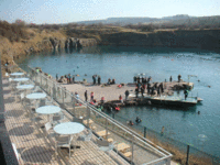
 Having not been to Capernwray for some years we were impressed with the facilities; the last time I came just one cabin stood in the car park.